


pont du tarn

Grouchat
User
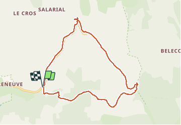

Length
9.3 km

Max alt
1393 m

Uphill gradient
143 m
Km-Effort
11.2 km

Min alt
1265 m

Downhill gradient
141 m
Boucle
Yes
Creation date :
2019-08-14 08:55:40.743
Updated on :
2019-08-16 18:12:38.155
2h59
Difficulty : Easy

FREE GPS app for hiking
 SityTrail
IGN / Geographical institutes
SityTrail Plus
The world is yours!
About
Trail Walking of 9.3 km to be discovered at Occitania, Lozère, Pont de Montvert - Sud Mont Lozère. This trail is proposed by Grouchat.
Positioning
Country:
France
Region :
Occitania
Department/Province :
Lozère
Municipality :
Pont de Montvert - Sud Mont Lozère
Location:
Le Pont-de-Montvert
Start:(Dec)
Start:(UTM)
562963 ; 4913634 (31T) N.
Comments